
Proclaimed a town in 1859, Walmer was on the edge of the deep leads gold mining area which extended through the Muckleford valley, under the Loddon Plains to, and connecting with, the leads being worked at Guildford, the Loddon valley and Vaughan. It is located where Fogarty Gap road crosses Muckleford Creek, about 8 kilometres north-east of Maldon. In 1891, Walmer had a population of 40.
Multimedia Content
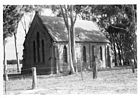
Walmer disused church, 22 April 1981, courtesy of State Library of Victoria.
Details